Depending on where you will sail in Croatia there are plenty of anchoring options on hand for any size of yacht. In this article, we will be focusing on Central and South Dalmatia, a route from Split to Dubrovnik. Let’s dive into the perfect spots to drop the anchor and enjoy the Adriatic Sea.
Lučice – Brač
GPS Location: 43°19’36”N, 16°27’3”E
Lučice Cove is located on the southern shore of the island Brač, it is a large anchoring spot offering protection from all winds in the most western spot. Not ideal for south, southwest winds in other spots.
The depths are ranging from 15-30m mostly with a sandy or mixed seabed, mind the shallow bed around the W point (Križ Point) and around the points of the coves in the middle of the cove.
The cove offers mooring buoys (for smaller vessels) and there is also a restaurant. You can check here what they offer. Excellent spot to relax before heading out to Hvar or Vis island.
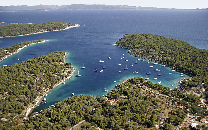
Ždrilca – Hvar
GPS Location: 42° 37′ 55″N, 16° 25′ 2″E
You can either anchor on the north side of the bay between Island Planinkovac and Marinkovac or on the south side of Island Borovac. Depths between 10-20m, seabed sand with seaweed patches.
It gets very busy in the high season (July, and August) so best to avoid those periods.
Found on the western part of Marinkovac Island, just under 2.5 nautical miles away from Hvar town is Ždrilca. Situated on the Pakleni Islands, is renowned for its numerous natural pebble beaches and unspoiled environment. Families are welcomed with open arms, as the restaurants offer a dedicated area for children equipped with a playground and a sea trampoline.
Fancy a massage? You can check it out here.
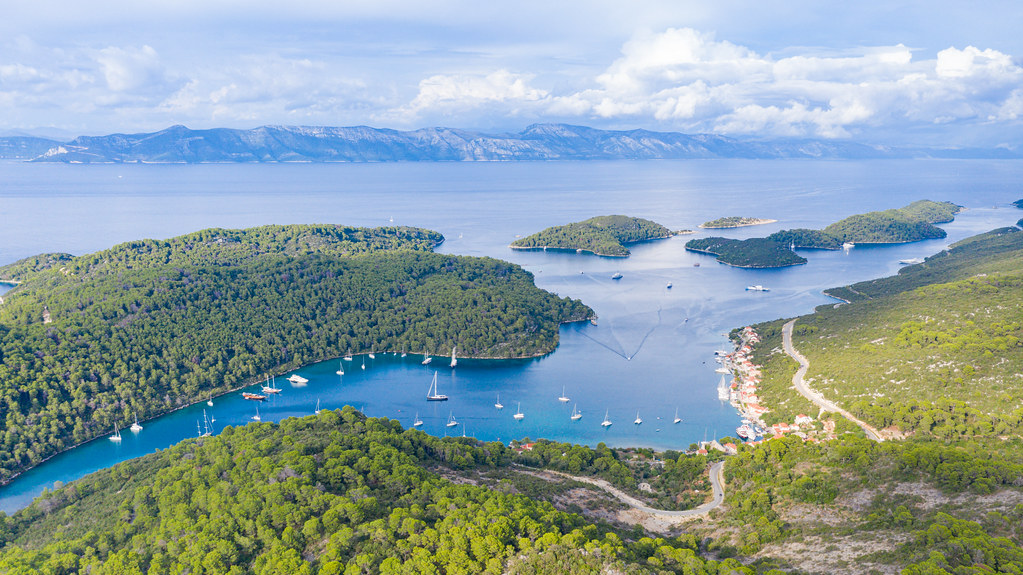
Stončica – Vis
GPS Location: 43° 3′ 59″N, 16° 14′ 34″E
Just shy of 10NM from Ždrilca lies Stončica Cove. It is located on the northern side of Vis Island, facing the open Adriatic Sea, giving good protection against NW and S, SW winds. Depths range from 5-40m.
The seabed of Stončica Bay typically consists of sand, gravel, and patches of seaweed. These characteristics often provide a good holding ground for anchors, ensuring that they can securely grip the bottom.
While Stončica Bay itself may not have many amenities, you can find a tiny beach bar or tavern nearby where you can relax and eat food from the area.
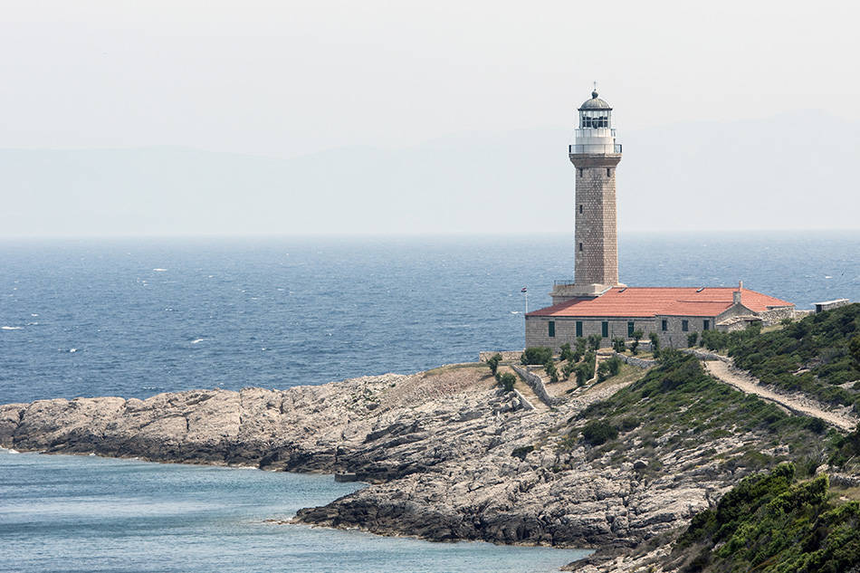
One of the prominent features of Stončica Bay is its charming lighthouse, which adds to the area’s allure. The lighthouse was built in 1865, It is made up of a 320 m2 ground-floor building and a tall, octagonal stone tower. A depot, an engine room, a dock, a boat hoist, and a boat shelter are also present.
Check out this drone shot of the lighthouse and the cove.
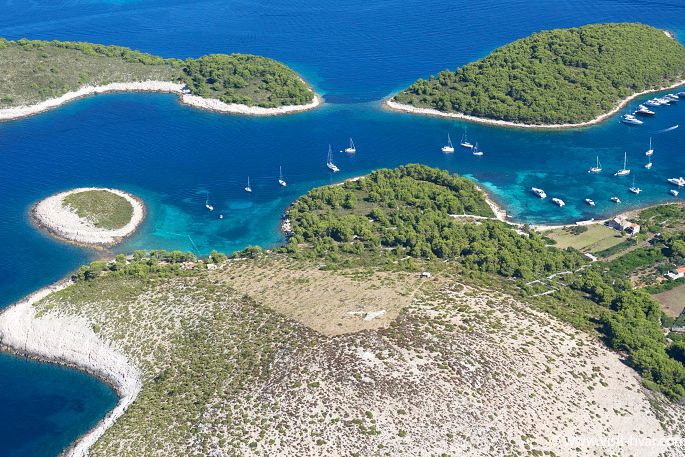
Badija – Korčula
GPS Location: 42° 56′ 58″N, 17° 9′ 31″E
The anchorage, which lies on the south side of the small islet Badija, enjoys excellent protection from northerly winds, and the rocky and sandy bottoms guarantee extremely good holding even in heavy gusts. Depths range from 20m in the center of the bay to 5m closer to Badija.
Never seen a Deer in the wild? Well on the island of Badija, there are 43 of them, which will enjoy your company. Watch out if you are bringing snacks, they can’t resist them. With gorgeous Renaissance architecture from the 15th century and one of the greatest views of the entire archipelago, visitors may easily spend an entire day here visiting, swimming, and unwinding.
If you are feeling adventurous you can jump in the tender and head to islet Stupa Vela where you will find a beach bar-restaurant Moro offering delicious food and drinks.
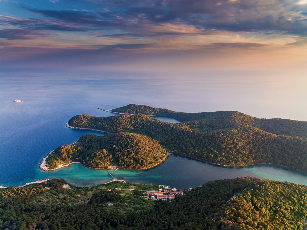
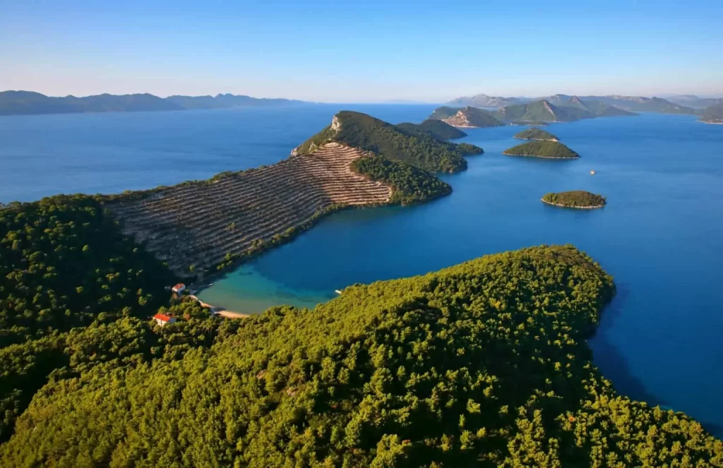
Kremena – Lastovo
GPS Location: 42° 45′ 29″N, 16° 48′ 49″E
The cove is located on the islet of Prežba, the bottom consists of seaweed and sand with seaweed patches. Depending on the bottom, the anchor holds moderate to poor. It is recommended to use lines on the shore (rocks) together with 2 anchors.
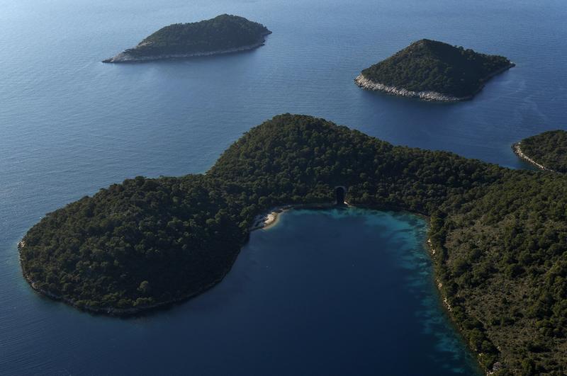
Since Lastovo was used as a military post and was off-limits to visitors from abroad until the 1990s, the island was still home to a number of abandoned barracks and tunnels built into the living rock at the start of the Homeland War there is one sea tunnel, the one in Kremena.
Lastovo is a Nature Park so be sure to respect the limitations and guidelines. For other spots, there are mooring buoys available but for smaller yachts, you can check more info here.
Veliki Jakljan – Island Jakljan
GPS Location: 42° 44′ 27″N, 17° 49′ 33”E
Jakljan lies between island Mljet and island Šipan, so it is an ideal swimming stop during your cruise to Dubrovnik. The seabed is mostly sand but plenty of seaweed so holding tends to be poor more far out of the bay, a longer chain is preferable. Depths far out are 20-30m, more inside the cove it drops to 6m.
If you are looking for a place to eat Konoba kod Marka is a tender ride away on the island of Šipan, offering fresh seafood for already decades by the Chef and Owner of the restaurant. For a fine dining experience, there is restaurant BOWA, located on the western tip of the island Šipan.
Polače – Mljet
GPS Location: 42° 47′ 26”N, 17° 22′ 37”E
Mljet is a Natural Park so there is a fee to be paid upon entrance, the bay of Polače is a very popular anchoring spot offering good shelter all around and good holding characteristics with the seabed being sand and mud, depth mostly 15m. From Polače it is easy to get ashore with a tender but if you want more peace and quiet we recommend going a bit to the east, just below islet Kobrva, and finding a spot there, depths are 20-30m. For eating out you will find restaurants as soon as you step on shore.
If you have never visited Mljet before be sure to check out the national park. The National Park is on the northwest part of the island and it covers a large area that borders the two lakes (the Great Lake and the Small Lake).
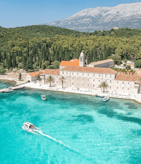
There is a Benedictine monastery with the Church of Saint Mary on the Isle of Saint Mary situated in the southern part of the Great Lake.
Lokrum – Dubrovnik
GPS Location: 42° 37′ 55.272″N, 18° 7′ 23”E
If you want to be close to the old town consider anchoring on the NW side of island Lokrum, depths here are from 20-30m with the seabed consisting of seaweed. Good protection from NW, W winds.
Besides visiting Dubrovnik consider exploring the island of Lokrum which is a nature reserve. The island is covered with lush flora and is home to a variety of unique plant species, including ones that were imported specifically (such as tropical types).
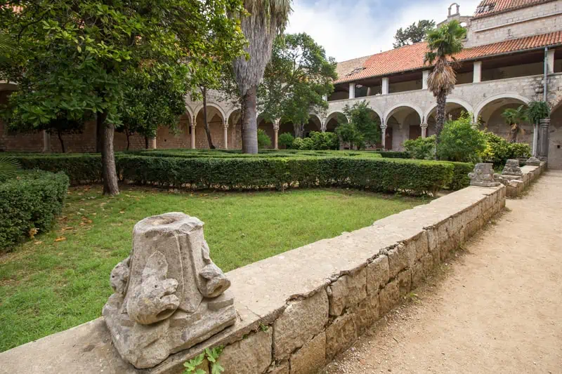
There is also a Monastery, although it was initially constructed in the 11th century, the portions that are visible now date from the 15th and 16th centuries. (The Monastery sustained severe damage as a result of the Dubrovnik earthquake in 1667.)
Found this article helpful? Please share it with anyone who would find it interesting and enjoy your stay in Croatia!